Tuesday, September 16, 2014

Tuesday, September 16, 2014: South of Virginia, MN to Orr, MN.

This morning we lingered over breakfast with our friends, enjoying their view of the lake and the early morning sun.  So until Cal began riding where we stopped yesterday, it was 10:00.  Today the terrain was flatter than yesterday, allowing Cal to ride 65 miles by the time we arrived in Orr, MN. It was 4:30 and time to stop for the day.   This morning when Cal began riding, the wind was coming out of the south, but during the course of the day, it turned so that by late this afternoon it was coming from the north!  Directly in his face!!  That wind!     

We are seeing more colors in the trees each day, so we know autumn is here! This has been an interesting year – we also went through autumn while in Australian and New Zealand in May & June!


Autumn Colors are appearing

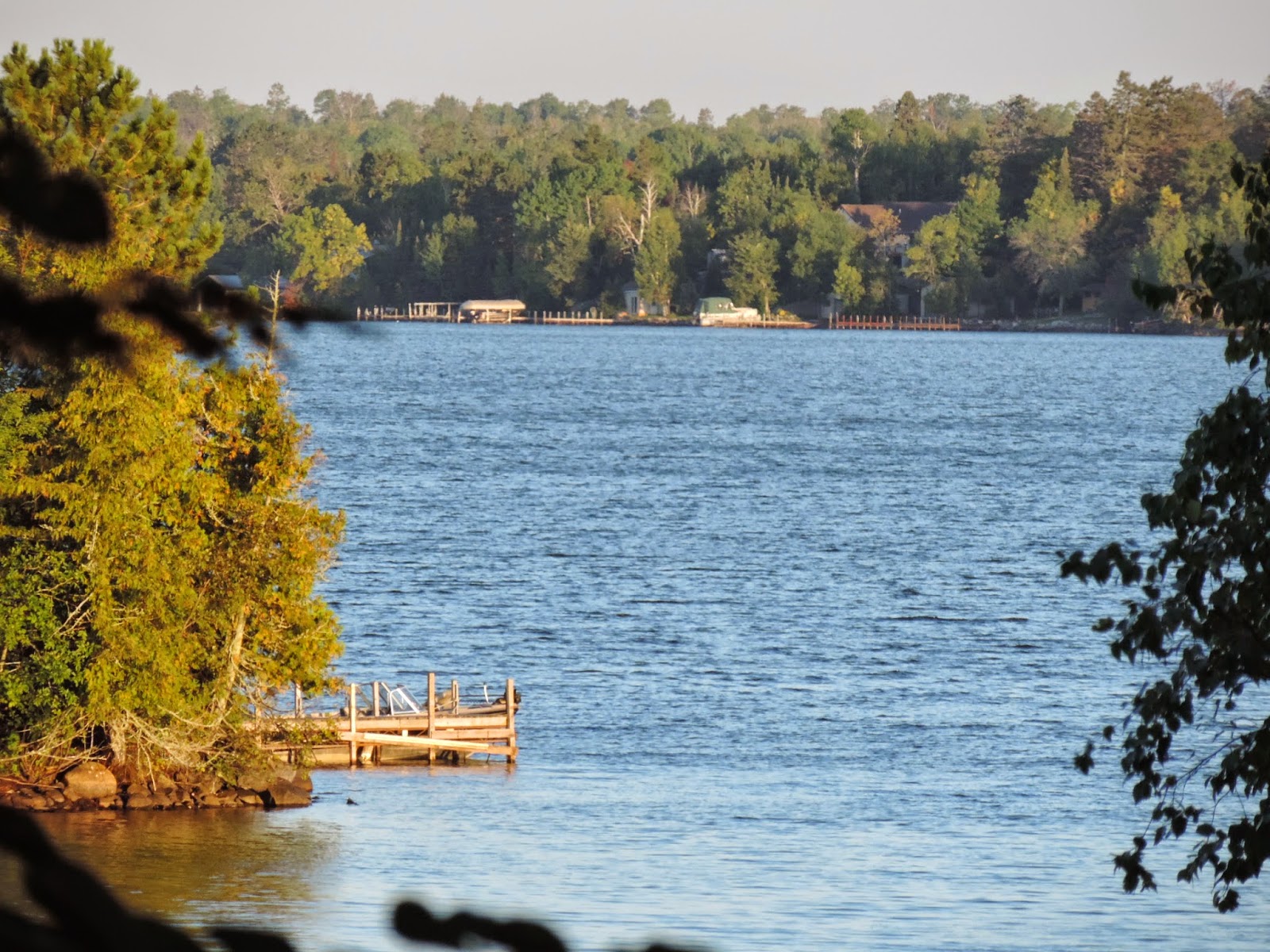
We are enjoying the beauty of the lakes.  There are tranquil feelings when you see lovely shorelines (some rocky, some with reeds), or you see boats or canoes at docks, or even empty docks.  They all give you a calming laid back feeling.     
The wildlife we have been seeing the last several days - Canadian geese, and deer, but numerous mature bald eagles have been flying over us.  Today one sat in a tree top right in front of Cal – his photo is out of focus. 
Today we crossed the Laurentian Divide – we had never heard of this.  This is the divide where the watershed of streams flows north to the Arctic Ocean, and the watershed of streams that go southeast goes to the Atlantic Ocean via Lake Superior and St Lawrence Seaway.  Interesting!  There is also a divide for the watershed that flows to the Gulf of Mexico via the Mississippi River.  This is stuff that we simply do not think about.
 
Tomorrow will be the last day!  Cal is ready to reach International Falls, MN.  He had approximately 55 miles to go, but he will have a head wind!!
Lodging in Orr, Minnesota - Pelican Lake


Pelican Lake from the Lodge
 

Monday, Sept 15, 2014: Duluth, MN to near Virginia, MN

Cal knew that this morning would be a tough ride.  He had to peddle up out of the river bottom at Duluth.  It seemed like continuous hills.  Thank goodness the shoulders of the roads were wide.  He finally arrived at Hwy #53.  We will be on Hwy #53 until we arrive at our destination, International Falls, MN, approximately 162 miles. The end is almost in sight!

Hills and scenery near Duluth


Country Church

Cal Bundled up to stay warm
Tonight we are staying with Rotary friends on Lake Vermillion so around 3:30 Cal stopped riding and we drove to our friends beautiful lakeside home.  Cal had hoped to ride a little farther today, but due to the hills he was short of his goal.  He rode 53 miles today.
I need to say a bit about the Rotarians we stayed with tonight.  Both of us couples were in Australia for the International Convention.  We were waiting for Registration to open when we met – a long way to go to meet someone!!  You never know who you will meet around the Rotary Wheel!  They definitely have a piece of Paradise on Lake Vermillion, MN where they live the year around.  He has a company that deals with the production of rubber lining for pipes that are involved in transporting iron ore.  We had no idea of the extent of the iron ore resources in this area.
Being on a Lake meant a boat ride before going to dinner at the lovely Fountain Bay Casino Country Club.    Lake Vermillion covers a large area and there are many lovely homes facing the waterfront.  Fountain Bay Casino is on Native American grounds.  We had a lovely meal and evening.
Boat Ride on Lake Vermillion


Boat and Dock

Our Friends Lake Front Home

View of the Lake from the Deck

Morning View of the Lake
 

Sunday, September 14, 2014: Siren, WI to Superior, WI (Duluth, MN)

It was another chilly morning.  The temperature was actually a little warmer than Saturday morning, but the wind was much stronger, so that it felt colder.  We drove back to Siren to the location by the lake where Cal stopped yesterday - one of the many Wisconsin lakes, and Cal began riding.   It was a sunny day, thank goodness, so it did warm up to be comfortable with a jacket. The topography is rolling with a few steep grades. At one point we left the Gulf of Mexico watershed and entered the Lake Superior watershed which in the end flows to the North Atlantic.  So when we crossed that watershed line it was in reality “downhill” to Superior!!!! 

Wisconsin has a series of roads called “Rustic roads”.  I don’t remember how, but we have a “Rustic Roads” guide book, however I don’t have it with me.  Along the way I have seen signage for several Rustic roads, but I have not driven on them.  This morning Cal would remain on the same road for hours so I decided to drive on two of the “Rustic Roads”.  These actually are just “back roads” that are very nice.  The one road went between two lakes whereas the other wound through a forest.  They were lovely drives.  The whole drive today was lovely – birch, aspen and pine forests surrounding lakes and marshes. The leaves are just beginning to change.  Every once in a while there is a bright red tree, but very few.
Siren - Lake along the road


Serene dock along the lake


Birch Forest
For lunch we stopped at a little gas station/bar and grill along the road (nothing else around).  We have been riding/driving in very rural Wisconsin today.  No major towns! This place the “Dry Dock” was also a DNR point where hunters bring their game to be weighed and tagged. Bear hunting season in Wisconsin began last Wednesday.  They were telling me there are approximately 40,000 black bear in northern Wisconsin.  Hunters in Wisconsin can use dogs, whereas across the line in Minnesota they cannot - we were approximately 8 miles from Minnesota. Last Friday this DNR point weighed and tagged 2 bear.  One weighed 142 lbs and the other 202 lbs.   
Local Scene at the Gar Station

Yellow River - Flowing North

Path in the Woods

High Trestle Bridge


After this lunch stop we came to an area where a high trestle bridge spanned a river gorge.  I stopped to take a photo of the bridge when I saw something black swimming in the water.  By the time I was in position for a photo, it was to the other side of the river – I think it was a black bear – if not, a large black dog, but since there are bear in the area I am certain it was a bear. 
We made it to Superior WI.  We loaded the bike and drove to a hotel in Duluth, MN. On our way we stopped at a Visitors Center at the top of a hill.  What a view of the whole area, the St Louis River, St Louis Bay, Superior Bay, Duluth harbor, Superior harbor, ships in the harbor, large grain elevators, an iron ore depot where they were loading ships, and the city. Duluth, MN and Superior, WI area is very busy (maybe not as busy as in its heyday).  In the hills above the city of Duluth there is a Skyline Drive. After dinner tonight in the refurbished Clyde Machinery Works, we drove on the Skyline Drive.  This is a beautiful way to see the city. It was just at dusk so the city lights were shinning.  
Another Scenic Lake along the road

Rail Cars loaded with Iron Ore


Docks where Iron Ore is loaded onto Ships
We had learned about iron ore being shipped out of Duluth when we visited the Upper Peninsula of Michigan several years ago, as most of the shipwrecks on Lake Superior were ships loaded with iron ore coming out of Duluth. The Edmund Fitzgerald was the last major ship wreck on Lake Superior in 1975.  While at the restaurant tonight we inquired about where iron ore is mined.  There are mountain ranges about an hour from Duluth (that we will be going near) that has underground and open pit iron ore mines.  
Due to the natural resource of iron ore in the area there were steel mills.  The Clyde Machinery Works made all sorts of machinery that was used to build the Panama Canal, San Francisco Bay Bridge, Hoover Dam, etc.  At one point Duluth was a very industrial city, including ship building during both World Wars.  Clyde Machinery Works is no longer in existence, so they have converted part of the complex into a great restaurant, bar, and event center, while keeping its history.  We are glad for the recommendation to eat there. 
Duluth at Night
 
Lift Bridge between Lake Superior and the Duluth Harbor

Saturday, September 13, 2014

Saturday September 13, 2014: Houlton, WI to Siren, WI

This morning we awoke to a cold 32 degrees!!! I’m not ready for this!!   Cal pulled out another layer of clothes!  Plus, at 7:00 am there was heavy fog.  However the sun was trying to burn it off!  Due to the fog we ate a leisurely breakfast and did not rush in packing the vehicle.  By the time we came to the spot where Cal stopped riding yesterday the fog had almost lifted, but due to construction we drove a few miles farther before he began riding this morning. 

As I said yesterday we are now following the St Croix River.  We will follow it north to St Croix Falls, but at that point the river curves northwest and we will follow the road north east.  Away from the river we were again dairy land.  I took a few photos of barns with silos and dairy.  I even saw those brown and white cows that give the milk for twist ice cream cones!!!  Chocolate and vanilla! 


Dairy Farm 


Guernsey Cows
Cal found a bike trail on which he road for approximately 7 miles, however it had a gravel surface.  He opted for the highway which had smooth shoulders.  Gravel slows him down and is twice the effort to peddle. 
Beside dairy, hay, soybeans and corn I saw another crop that I could not identify (somewhat like a soybean plant, but shorter and different).  Then all of a sudden coming toward me on the road were these huge pickers – 7 of them – big combines like machines for soybeans or corn, but they had a huge roller on the front.  I saw the field these pickers had just left, but I still had no idea what they were picking.  Then I noticed a semi-trailer that was being loaded from these pickers.  I pulled up to the semi and asked the driver what it was they were picking – Green beans!!!! Tons of green beans for a canning factory in the area! Very interesting!  Yesterday we saw fields that we think were sweetcorn for canning/freezing for human consumption.  The plant and tassel looked different than regular field corn grown on farms, plus the plants were greener.  We keep seeing roadside stands still selling sweet corn. I would love to buy some but how would I prepare it! We know there is a Jolly Green Giant processing plant within 100 miles of this part of Minnesota/Wisconsin, but there is another processor in this area.   

Green Bean Pickers
Today I did stop at a Farmers Market and bought a container of locally grown cherry tomatoes.  I was looking for fruit, and this was my option.  They were great.
Cal rode as far as Siren, WI today but the hotels/motels in town were full due to 3 weddings and a funeral, so we had to drive to where we are tonight.            

Friday, September 12, 2014

Friday, September 12, 2014: Hager City, WI to Houlton, WI

Our Rotary event is over (all went well) and now it is “back to business”!  The temperatures have dropped some more!! This morning it was 43 degrees when we woke up!! We loaded our gear and drove north again (100 miles) to Red Wing, where we crossed the Mississippi to begin riding where Cal had stopped on Tuesday in Hager City, WI. Due to the length of our drive north, breakfast, and a stop to buy gloves and head gear, it was 10:30 before Cal was on his bike. 

One of the rocky bluffs we drove past

Another Train along the Highway
Somehow the hills have not diminished!  It reminds Cal of riding RAGBRAI through southern Iowa, one hill after another!!
Today our views of the Mississippi have been more hindered with trees, but the rail tracks and the river are still to the west.  At Prescott the Mississippi River continues more westerly through the cities of St Paul & Minneapolis while the St Croix River flows into the Mississippi from the north.  At Prescott we continued north in Wisconsin so instead of following the Mississippi we are now following the St Croix River.
I really did not take many photos today.  There is a Great River Visitors Center in Prescott, where the St Croix flows into the Mississippi, but viewing was very poor due to trees in the foreground.
Tonight Cal stopped riding in Houlton, WI so that we could cross the River into Stillwater, MN where we are staying.
 
A Tree Farm Along the Highway


A Horse Farm


Tuesday, September 9, 2014 - Marshland, to Hager City, WI

Overnight we had rain, but by morning only cloudy skies remained.  Since we stayed in Trempealeau overnight, this morning we needed to drive back to the end of the bike trail where Cal had stopped riding last night. Cal actually rode about 10 miles this morning before we stopped in Fountain City for breakfast. Due to the cloudy conditions and the storm that passed through last night, the temperatures have fallen.  We are not ready for this!!   

Marsh along the edge of The Mississippi River

The Mighty Mississippi River


The Church in Fountain City

A small Barge on the Mississippi River
Today we went through several towns with nice gift shops.  I spent time in Alma & Stockholm. In Alma we also saw a barge going through Lock & Dam #4.   Later we had ice cream in Pepin, WI the birthplace of Laura Ingalls Wilder (of Little House on the Prairie fame).  Pepin has a very nice museum relating to Laura and the time in which she lived.  I did not drive 7 miles into the country where a replica cabin is located on the land previously owned by Laura’s family (her birthplace). 
Lock and Dam in Alma, Wisconsin

A barge going through the Dam


The Train coming by the Dam

A memorial in Alma, Wisconsin


There continue to be pull-out areas for Mississippi River viewing and historical markers.  Many locations along the Mississippi and other waterways flowing into the Mississippi have French and Indian history, as these were the interstate highways of the day!

The topography is again hilly for Cal but he reached his destination of Hager City, WI.  There is a bridge crossing the Mississippi River from Hager City to Red Wing, MN.  On the Minnesota side of the River, Hwy 61 is a major highway. You have to plan where to cross the Mississippi as there are not bridges at every town.  From Red Wing, MN we drove south approximately 100 miles (1 ½ hours) to return to La Crosse, WI -Crossing the Mississippi again!  We will be in La Crosse until Friday morning for a Rotary event.  I took a photo from our hotel lobby of the Mississippi River Bridge at La Crosse.