Friday & Saturday, September 22
& 23, Jasper National Park, Icefield Parkway, Banff National Park, Lake
Louise and on to Whitefish, Montana
I did not write
last night, as we stopped too late. I am
going to combine both Friday and Saturday, as we were in both Jasper &
Banff National Parks on the Icefield Parkway.
Each morning
there has been fog until about 10:00 am, when the sun finally burns it
off. Therefore, we have not been in a
hurry to get out and going in the morning - as the fog has been too dense. By the time we arrived in Jasper it was after
lunch. We drove to Pyramid Lake just
outside of Jasper, before getting on the Icefield Parkway.
 |
| Mount Robson |
 |
| Our first Elk |
I don’t know
if there is a place in the world like the Icefield Parkway. It is just a continuous drive of mountains,
usually on both sides of the road which is in the valley, alongside the
river. The mountain peaks are so
interesting. Right now, with the
“termination snow”, it accentuates the ridges and strata’s in the
mountains. There was still plenty of
daylight so we kept driving, stopping often to take photos – all around
us. It was a beautiful mostly clear day.
The sun was better on the mountains to the north and east, but we took them all
around.
There is a
lot more traffic on the roads than we have experiencing the last few weeks.
There are many pull-outs, plus there is a wide shoulder on the highway for cars
to pull off for photos. There are also
areas to park, allowing you to walk to waterfalls or beautiful reflective
lakes. We did not stop at every pull-out, nor did we do any long hiking trails,
except for this morning. Cal walked to
Peyto Lake at Bow Summit. The trail was
icy from the snow that had fallen in the area 2 days ago. I did not change shoes to be able to go with
him.
 |
| Athabasca Falls |
 |
| Our second Elk |
We did see
some wildlife along the way. There was a herd of elk right beside the road. There was a male, 3 females, and numerous
young. At another location, there was just a single male elk. There was one
medium sized black bear that decided to scamper into the wooded area, instead
of poise for us.
We also
discovered that most of the campgrounds are already closed for the winter, even
though there are lots of campers on the highway. Motorhomes were parked in parking lots. We kept driving, as it was not dark. Finally, we reach Rampart Creek campground, which
is open until Oct 9th unless there is too much snow. By now it is 7:45! We found a nice spot, made
a light supper on our stove/burner, and crawled in for the night by 8:30. It was a beautiful clear night. There were millions of stars shinning, as
this is in a very dark location. We saw
the stars until early morning, but by 8:30 when we woke, it was foggy. We were looking forward to a clear day! It was 34 degrees, so getting up is a quick
process!! We drove a few miles to a restaurant for breakfast, taking our time,
as we were sure the sun would burn off the fog.
By the time we finished breakfast, sure enough it was almost clear and
the clouds were continuing to rise.
 |
| Athabasca Glacier |
After Jasper
National Park we continued into Banff National Park. At Lake Louise, we ran into a traffic jam. Vehicles and more vehicles! Parking lots were overflowing. The parking lot at Lake Morraine was full –
they would not let more traffic drive there, so after viewing Lake Louise, we
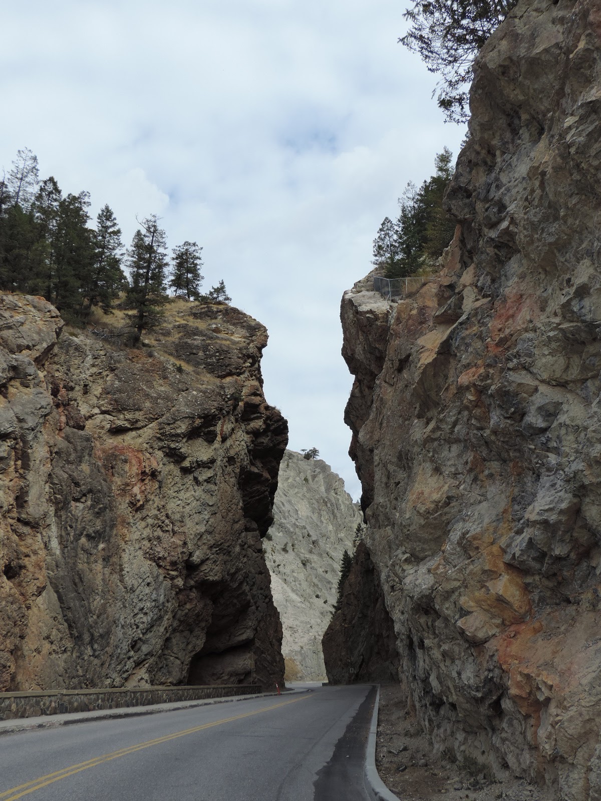
continued southwest through Kootenay National Park to Radium Hot Spring, BC. It
was a lovely drive, but after the Parkway, nothing can beat it!
We are going
this way so we can drive the “Going to the sun” road through Glacier National
Park in Montana. We crossed the Canadian/American border at Roosville, Canada,
and drove to Whitefish, MT for the night.
 |
| Snow along the Trail |
 |
| Peyto Lake Cal hiked to see |
 |
| Beautiful Reflection |
 |
| Narrow highway opening at Radium Hot Springs |
 |
| A Saw Mill |